 |
| Satellite imagery from Environment Canada shows the percolating weather system off the North Coast, upon arrival by Friday we trade cold for warmer temps and rain |
Hang in there Prince Rupert, if the latest forecast for the next fourteen days holds true, this current Arctic weather experience will soon come to an end, replaced by more familiar temperatures and another familiar weather feature for the North Coast ... Rain
The last of the Arctic Outflow warnings should be gone by Thursday evening as what appears to be a warming trend from the Pacific pushes that arctic ridge back north.
That however will make for a pretty significant temperature swing with a Christmas Day Hit of 7 degrees above.
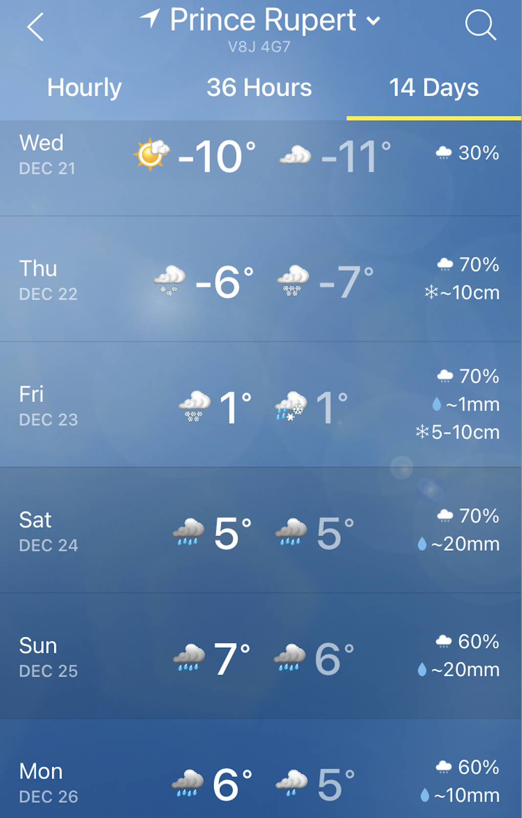
Also coming our way to complicate things for City workers currently battling the good Fight of Broken Pipes, will be some snow to come Thursday and Friday.
Environment Canada is currently calling for 10 cm of snow on Thursday and an additional 10 cm into Friday, that will be quickly followed by a sharp rise in the temperature and arrival of 50 mm of rain from Christmas Eve to Boxing Day.
The Weather Network's fourteen forecast has Temperatures remaining above Zero through the New Year and into the first week of 2023.

Follow Environment Canada for updates to the forecast and as the snow arrives Thursday, Drive BC for the latest road conditions across the Northwest.
More notes on past weather events on the North Coast can be explored here.
No comments:
Post a Comment