 |
| Watches and Warnings make for the New Year's Eve forecast |
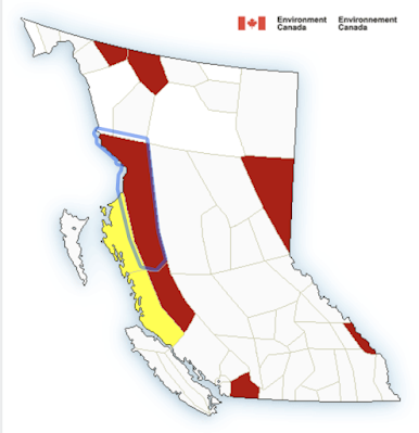
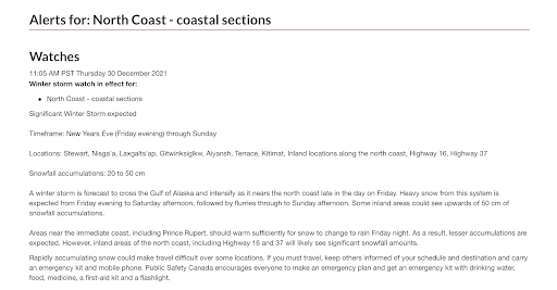
2021 is going to go out with a blast, a wintry blast, as Environment Canada issues a Winter Storm Watch for the North Coast, both for those inland and on the coast.
The Watch which was issued this morning notes of significant snowfall particularly for the Nass Valley, Terrace and Kitimat regions with up to 50 cm of snow possible before the approaching weather maker moves on.
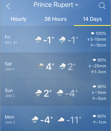
For the Prince Rupert area, the Environment Canada Forecast notes that while we may see some snow on New Year's Eve afternoon, a warming trend over the next few days will bring rain, starting Friday evening and continuing through the weekend.
However, don't put the shovels, salt or ice melt away just yet, the cold temperatures will return to the coastal areas of the North Coast on Monday and through next week
 |
| click to enlarge |
For those that may be making plans for an eastbound journey for New Years, you can access the Drive BC updates from their website and Twitter Feed.
You can also get a look ahead to the road conditions from the Highway camera locations across the Highway 16 corridor and feeder routes.
To review some of our weather of the last month see our archive page here.
No comments:
Post a Comment